Here is Benson Lossing's description of the site of Fort Montgomery in 1848:
"We decended the hills, and proceeded to the site of Fort Montgomery, a rough promontory on the north side of Peploap's or Poplopen's Kill. It terminates in a steep cliff at the mouth of the stream, and was an admirable situation for a strong fortress to command the river. Almost the entire line of the fortification may be traced upon the brow of the cliff, which is rocky, and bare of every thing but stinted grass and dwarf cedars." 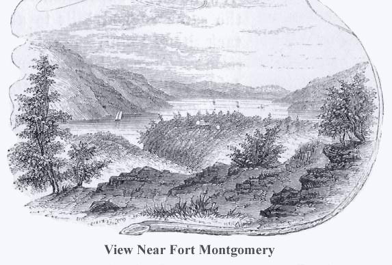 This view is from an eminence near the mountain road, about three quarters of a mile in the rear of Ft. Montgomery. In the distance, the cultivated slopes of West Chester, between Peekskill and Verplank's Point, are seen. On the left is the high, rocky promontory called Anthony's Nose; on the right is the Dunderberg, with a portion of Beveridge's Island; the buildings in the center of the picture, owned by Mrs. Pells indicate the site of Ft. Clinton; toward the right is seen the deep ravine through which flows Poplopen's Creek, and on the extreme right, partly hidden by the tree in the foreground, and fronting the river, is the site of Ft. Montgomery.
 |
Copyright © 2010,
The Loyal American Regiment